
Enquiries, prices and samples, email info@silvermaze.co.uk

WELCOME
Thank you for visiting our website. Below, you will find various subjects that complement the above directory. The examples in the Mapping Gallery may provide ideas for your city, town, or establishment map.
To provide a non-obligatory quote, we require just two pieces of information:
- Area: Specify this by naming a street in each direction to indicate the map perimeter, or by illustrating the area on an existing map.
- Style: The standard styles are two-dimensional, three-dimensional, or a combination of both.
Should you require something diffferent or general map making advice we are available to assist you.
Derek Reed
DEPENDABLE, EFFICIENT MAPPING SOLUTIONS
A recent comment from an overseas client. “Good morning Derek, This (the map) is wonderful. Thank you so much for your help.”
THIS IS WHAT OUR CLIENTS SAY:
“We thought the map we wanted was impossible but the accommodating manner in which Silvermaze approached the project meant it proceeded with ease” Arup Engineering
“The Mayfair map is the finest example of 21st century ‘3D’ mapping” Independent Newspaper
LATEST NEWS
A home of Art Deco The new map shows Miami Beach’s Art Deco heritage
Insult or compliment? Is this useful information or comment on map quality?
Map Balls? Footballs, Eyeballs, Snowballs, Fireball’s even Screwballs, but map balls?
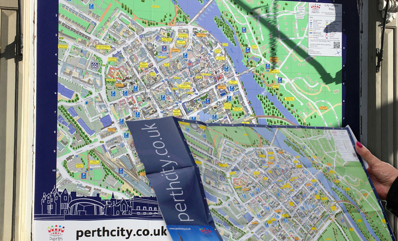
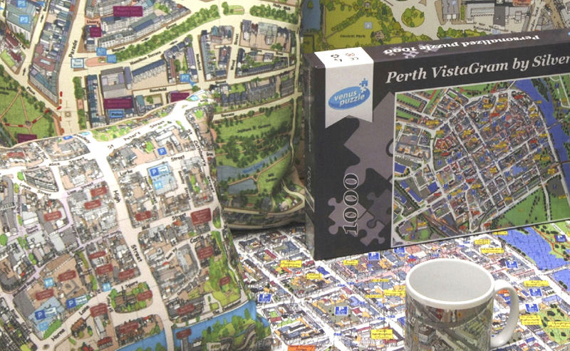
Perth gets’ signed up Scotland’s Perth City Centre now boasts an array of 3D map signage.
Caerllion Map. Now available in hotels nationwide.
London 1896. Did you know that London’s Imperial War Museum was a Lunatic Asylum, that there was an Oliver Twist type workhouse in Kensington or a specialist cancer hospital in Fulham Road? It’s fascinating what our London map of that year shows.
Is this heaven? What a place to reside, beautiful houses set on a picturesque estate with a golf course meandering through, boating lakes, sport centre and entertainment venues. Our new maps acts as a wayfinding tool and real estate sales aid. See News Page
MAP PRODUCTS
CLIENT MAPPING EXAMPLES
Our mapping gallery shows maps in various styles including 3D (illustrated maps) 3D/2D Combination, 2D and entirely bespoke maps. All have been created for clients and might help generate ideas for your own city, town or establishment map. See more
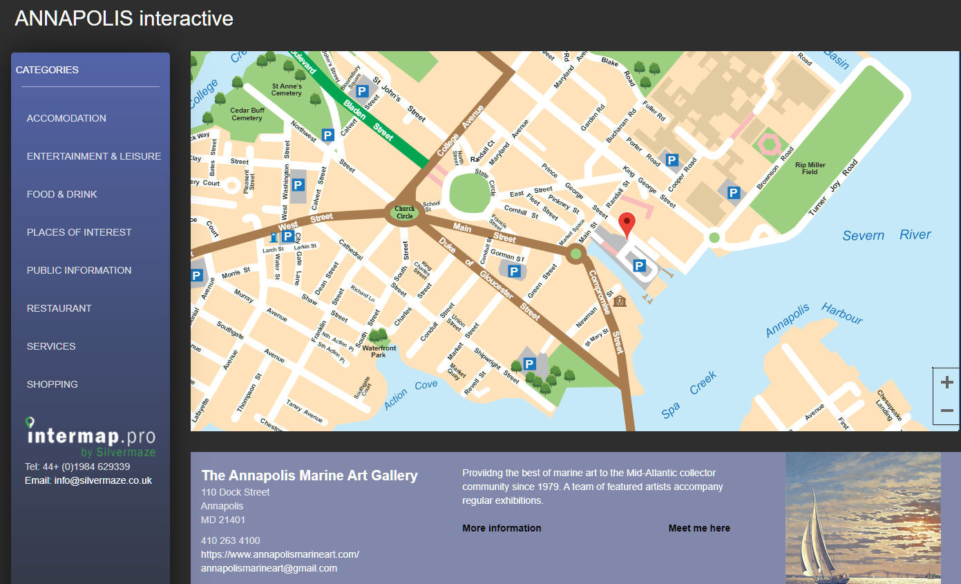
INTERACTIVE MAPS
Intermap.pro, the mapping platform created by Silvermaze, takes your static vector map into a whole new world. It pinpoints and promotes interest sites, businesses, shops and stallholders with text, images and video. See more
MAP PRINTING
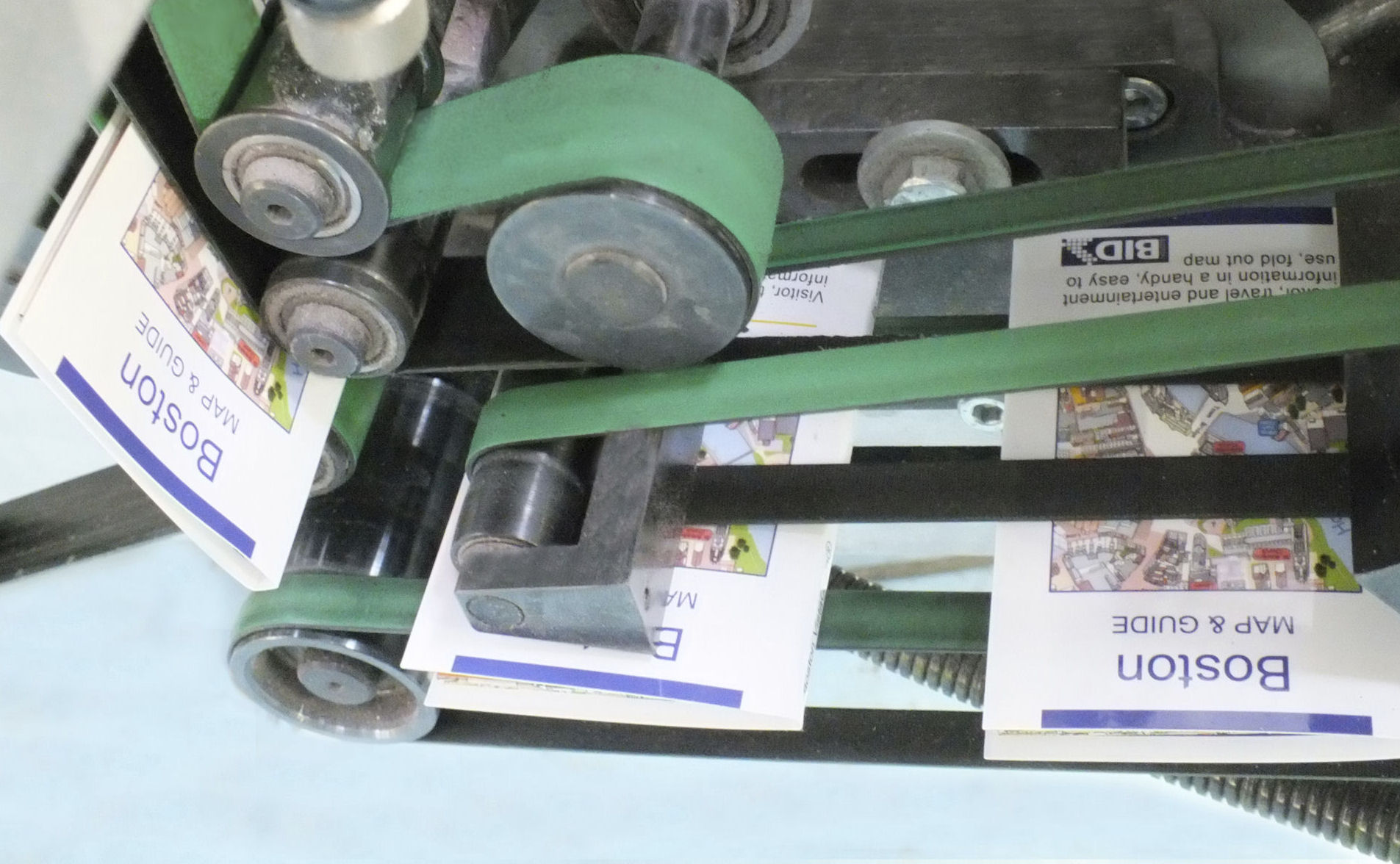
We offer a wide range of printed map products including our popular Little Book and Znapfold booklets, standard map formats, hotel reception maps, postcards and uniquely, a host of promotional items. See more

DISPLAY PRINT
Decorate the office with your town map wallpaper, a framed or canvas print or monitor changing information on a wipe-off laminated version. Maps can also be supplied as banners and panels for reception, events and exhibitions See more
EXTERNAL SIGNAGE
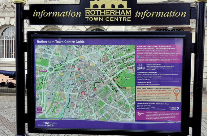
Our maps look sensational in information points around the city or town. Scotland’s Perth has nine different sized versions in the town centre. Alternatively more economical versions can be supplied on Di-Board or Correx. See more
MAP GIFTS & LOCAL SALES
Unusual town gift solutions or profitable inventory for local traders. We are often contacted by visitors to our shores to provide a momento. One American ordering an A0 print of 3D Royal Leamington Spa map for his hallway. See more
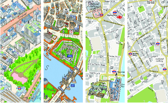
FREE LONDON MAPS
We will supply FREE extracts of our London maps for use on your website in either our 3D Modern, 3D Classic, 3D/2D Combination or 2D maps providing the area is covered. We do ask that an acknowledgement is included. See more
HISTORICAL SNIPPETS
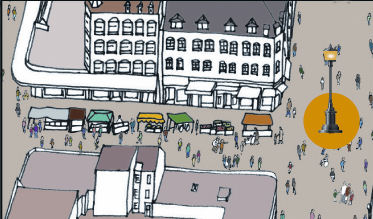
We use our 3D London Modern and Classic maps to relate some interesting and little known facts of London’s past. The above image shows Electric Avenue, Brixton; this prosperous market was the first to be lit by electric lights in the 1880’s. See more
SILVERMAZE
30 Norden's Meadow
Wiveliscombe
Somerset TA4 2Jw
T 07753 302 806
E info@silvermaze.co.uk